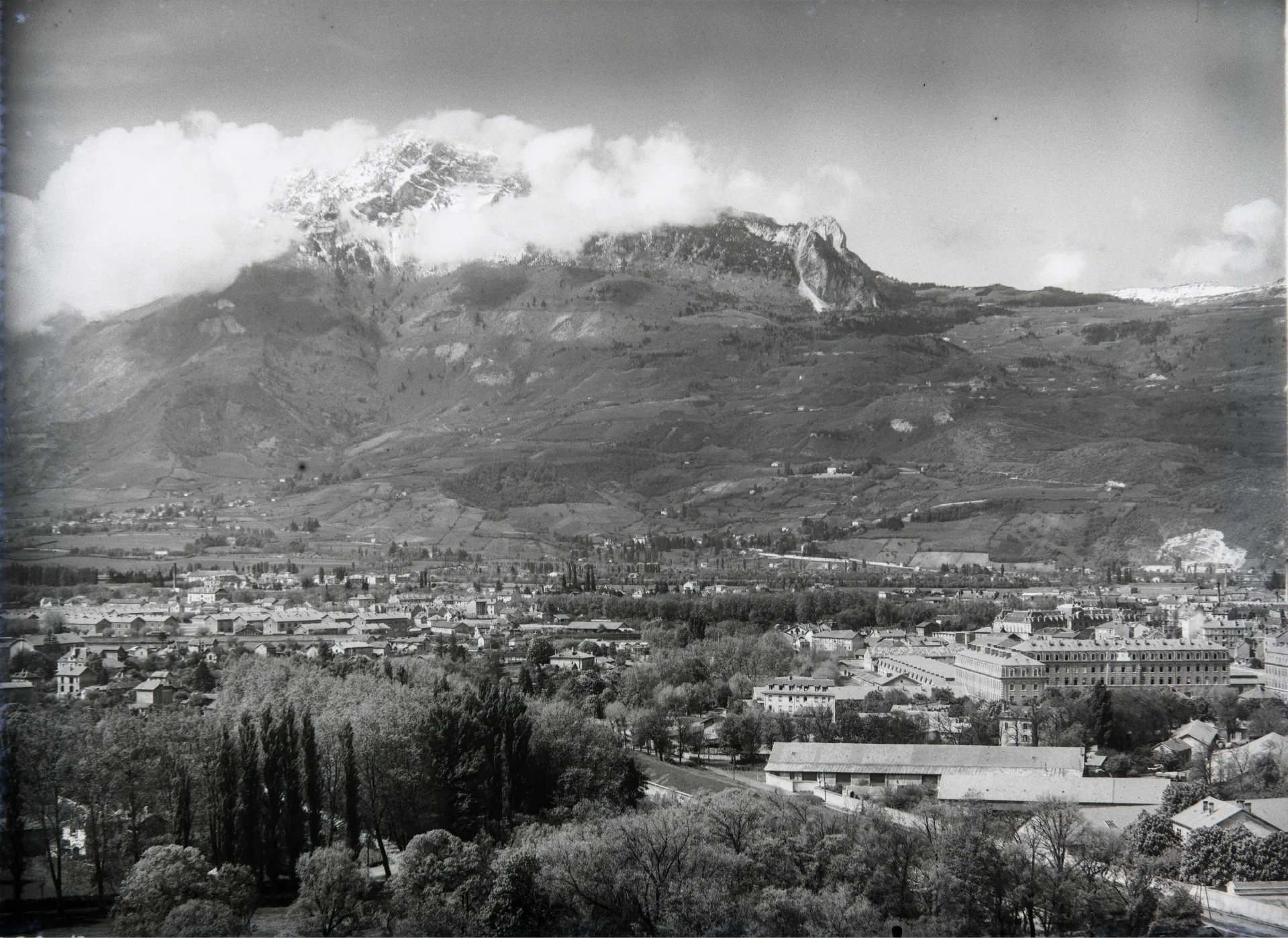
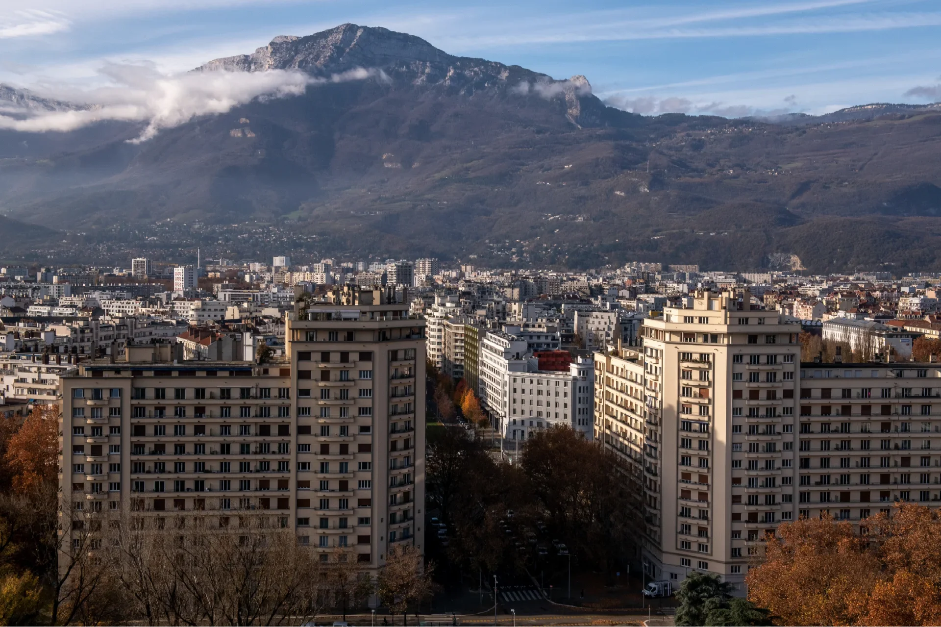
From a ring of city walls to a ring of boulevards
In the early 1920s, Grenoble was still surrounded by fortifications and occupied by extensive military bases. The organisation of the 1925 International Exhibition marked the start of the city walls' demolition. Gradually, the layout of the fortifications was replaced by a major urban thoroughfare known as Les Grands Boulevards.
In the second half of the 20th century, this axis became a key driver of urbanisation: it was home to high-rise buildings and transport infrastructure, eventually becoming fully integrated into the contemporary urban fabric.
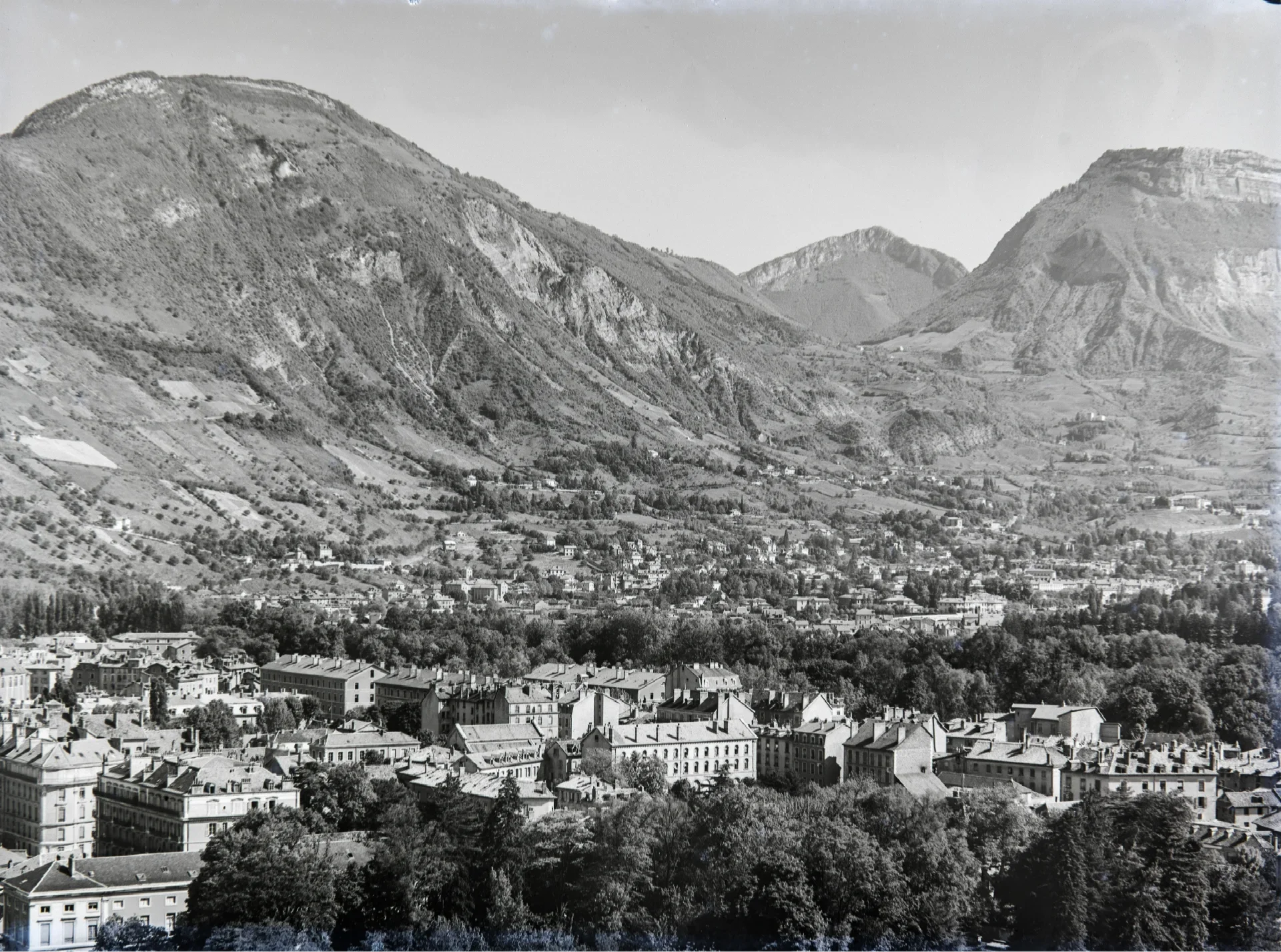
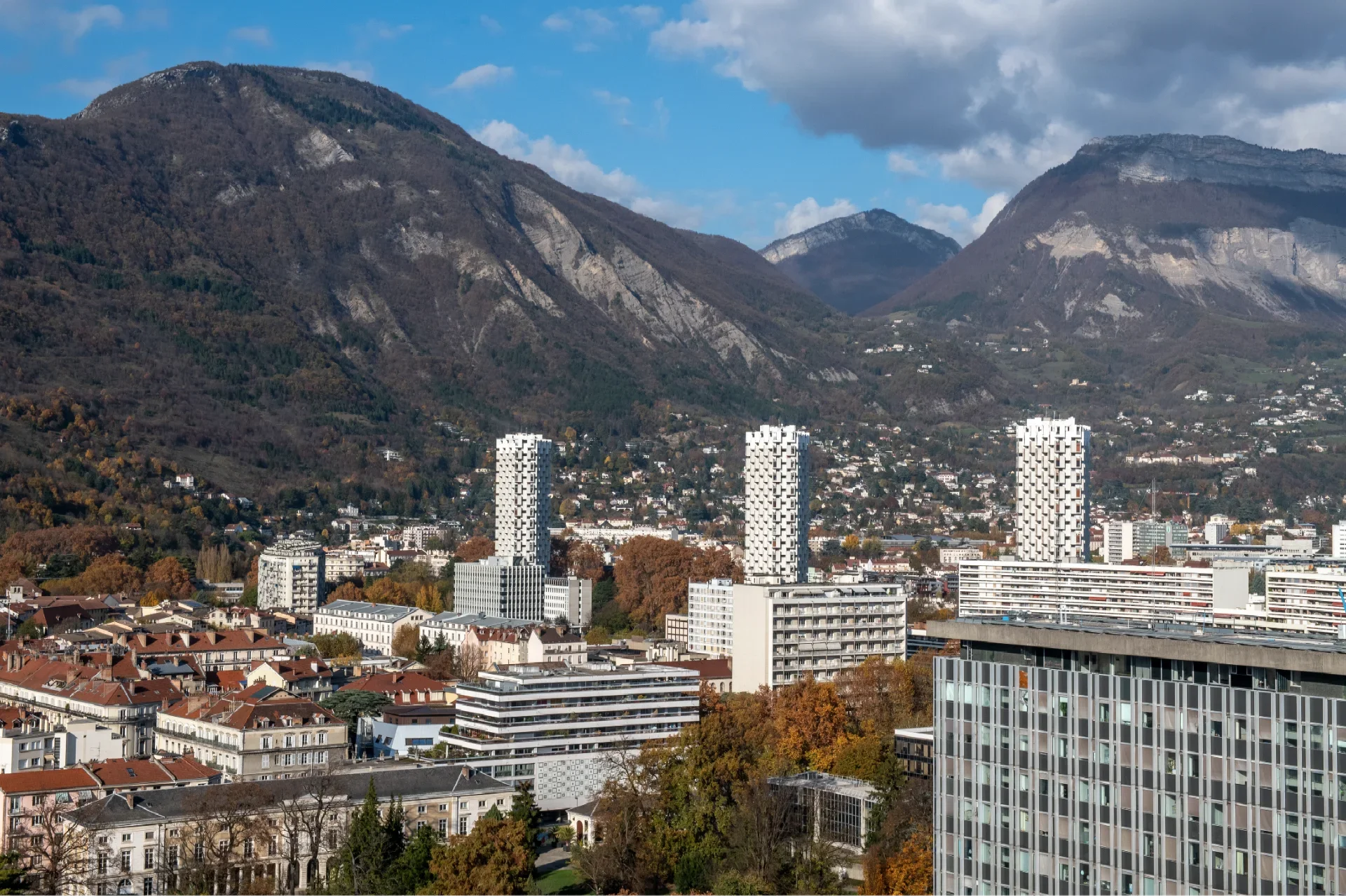
From a vineyard to a wooded residential hillside
In the early 20th century, the slopes of the Chartreuse were home to a vineyard covering more than 200 hectares, planted with local grape varieties that benefited from the sunshine and climate of the Grésivaudan Valley. Phylloxera in the late 19th century and various crises gradually led to its decline.
Today, these wine-growing areas are largely built up and wooded. Over the past fifteen years or so, however, replanting initiatives have sought to reconnect with this wine-growing heritage, thereby helping to open up and diversify the landscape.
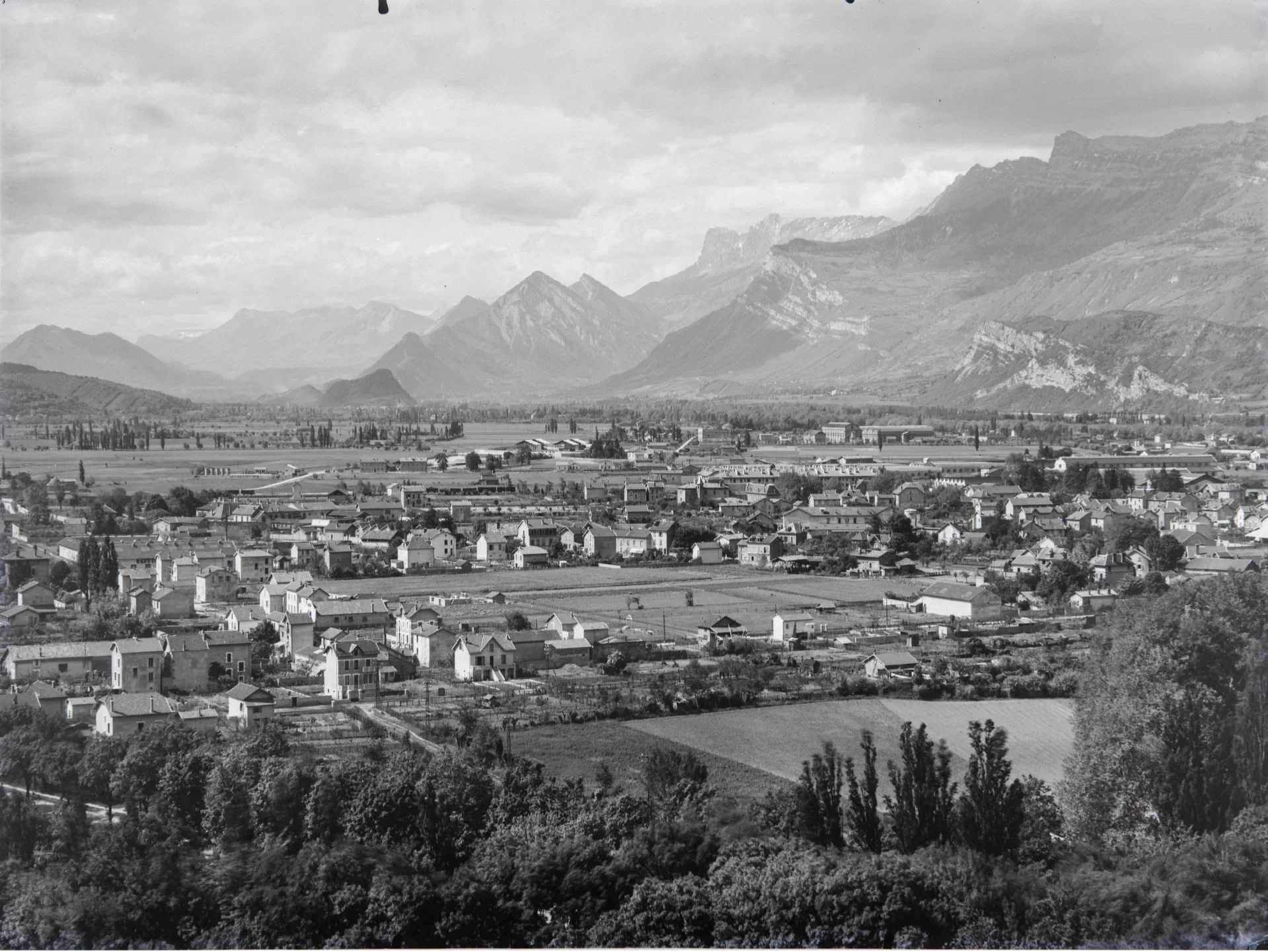
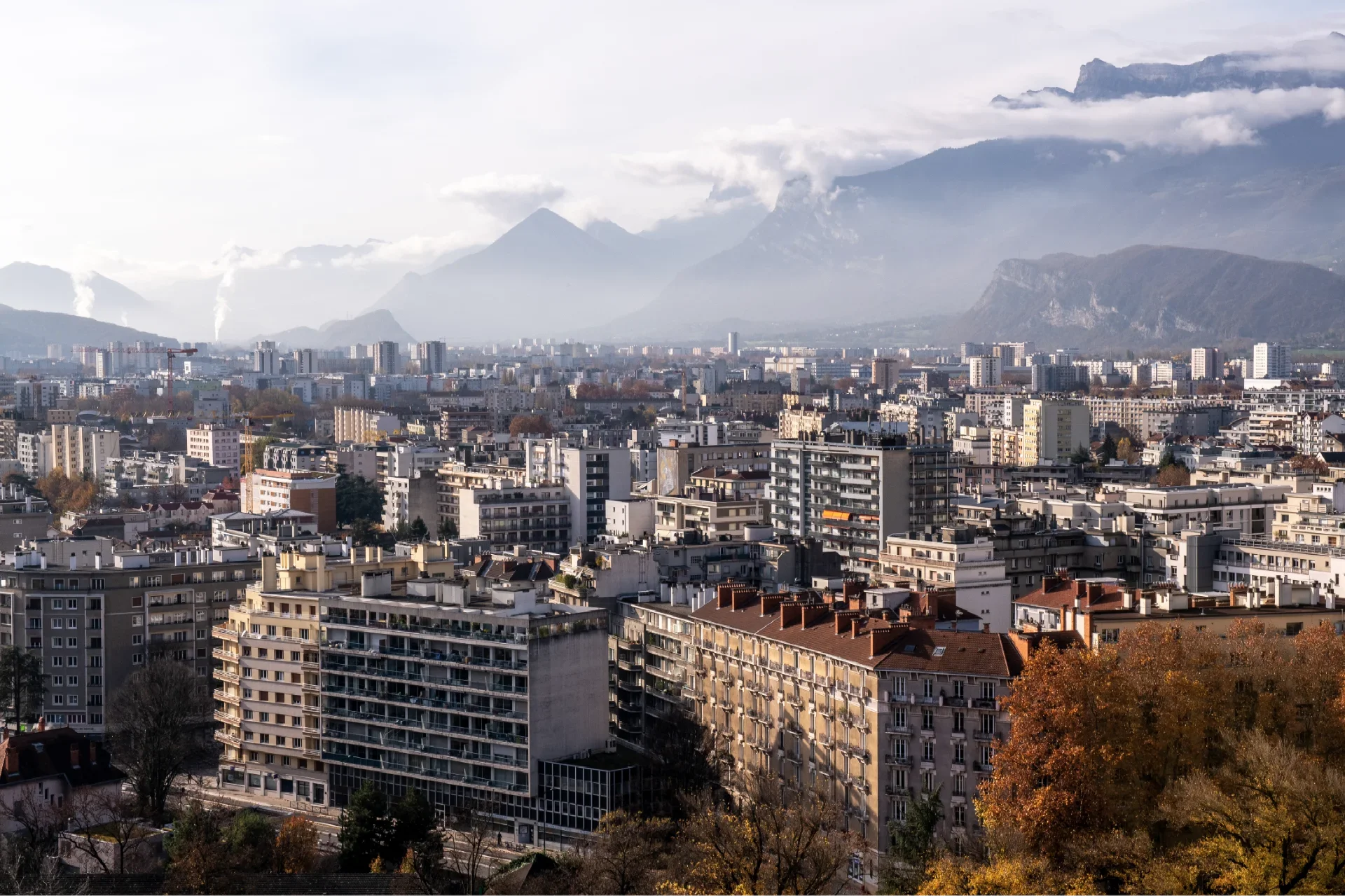
The urbanisation of the agricultural plain
In 1925, the plain was divided between cereal and industrial crops (hemp, tobacco, beet) and market gardening near inhabited areas. Rapidly expanding working-class suburbs were emerging within this agricultural landscape, characterised by houses with gardens often used as vegetable patches. The more modest houses belonged to workers, whilst the more affluent ones belonged to foremen and employers. Factories, situated right next to the houses, formed an integral part of the landscape.
After demolition of the southern city wall began in 1921, the city continued to expand, particularly during the second half of the 20th century; the agricultural plain was eventually entirely built up.
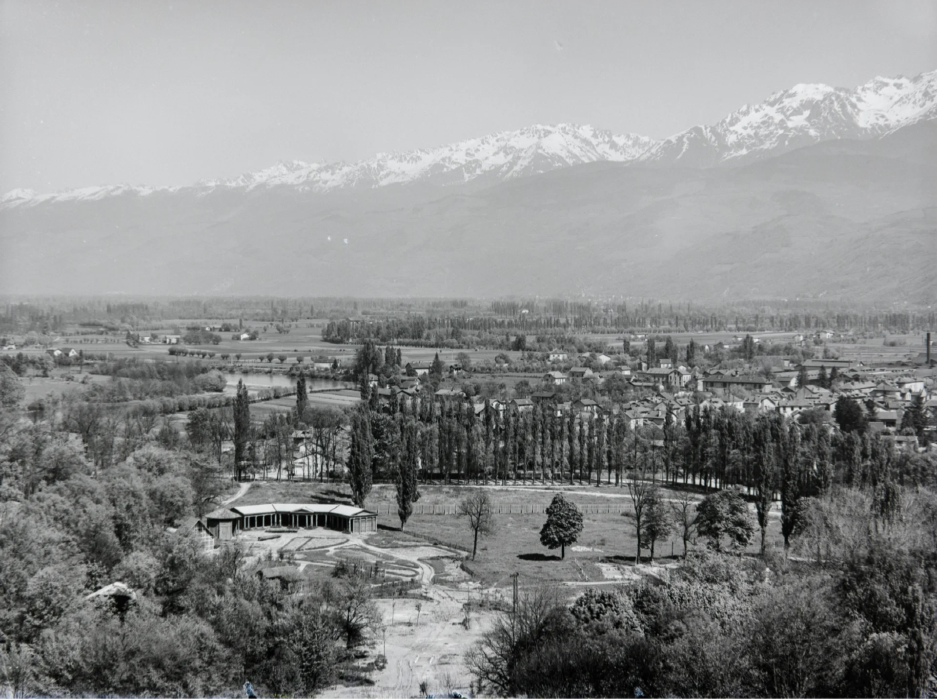
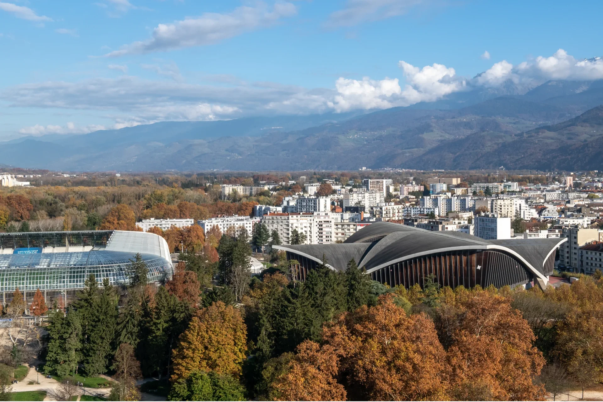
A woodland that has stood the test of time
In 1925, the least flood-prone parts of the Isère plain were used for industrial crops (hemp, beet, tobacco) and cereal crops to feed livestock. The wetlands were covered with natural vegetation. A hundred years on, this vegetation has spread along the banks of the Isère, creating a biological corridor.
Following the 1925 International Exhibition, the site upon which the event was held was turned into an urban park. Several sports venues have gradually been developed within Paul-Mistral Park: the ice rink in 1968 (on the right; now the Palais des Sports) and the Stade des Alpes stadium in 2008 (on the left).